Starship Navigation
Navigating a starship requires an enormous amount of data to help pinpoint the vessel's position.
 Federation starships navigate the galaxy by combining a massive database of information with sophisticated
onboard sensors that can pinpoint the vessel's position accurately. The
USS Enterprise NCC-1701-D was capable of calculating its
position relative to the galactic center, or another 'fixed' reference point such as Earth, to within 10
kilometers; even at high warp speeds, the ship could determine its location to within 100 kilometers. In
close maneuvering of the kind required when docking, the Enterprise was able to maneuver with distances as
accurate as 2.75 centimeters.
Federation starships navigate the galaxy by combining a massive database of information with sophisticated
onboard sensors that can pinpoint the vessel's position accurately. The
USS Enterprise NCC-1701-D was capable of calculating its
position relative to the galactic center, or another 'fixed' reference point such as Earth, to within 10
kilometers; even at high warp speeds, the ship could determine its location to within 100 kilometers. In
close maneuvering of the kind required when docking, the Enterprise was able to maneuver with distances as
accurate as 2.75 centimeters.
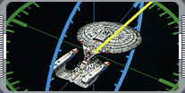
Navigational operations on the Enterprise were normally controlled from the conn after the commanding officer
had given a destination or heading in one of five ways. The easiest method of giving a heading was to name
the destination; as soon as this was inputted into the coon, the ship's computers consulted the navigational
database and automatically plotted the ship's trajectory. Destinations range from planets and star systems
to orbital facilities. If an area as large as a sector was specified, the Enterprise's computers generated a
flight path to the center of that area. It was also common for the conn to be given a moving destination
such as another spacecraft. As long as the vessel was within sensor range, the computer could plot an
intercept course. This kind of order required the conn officer to input either a velocity or an intercept
time, so that the course could be calculated relative to the position of the other craft.
Navigation instructions could also be given by specifying a destination's galactic coordinates; however, this
 method of navigation was rarely used, as it required personnel to either calculate or look up the relevant
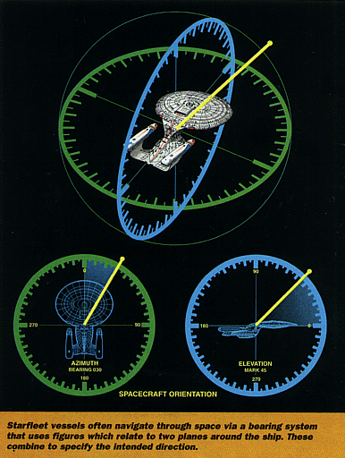
coordinate information. Navigational orders were more often given as a relative bearing. This consisted of
two figures which related to two perpendicular planes around the Enterprise: the first plane was horizontal,
the second vertical. Each plane was divided into 360 degrees, with 0 degrees deemed to be straight ahead.
method of navigation was rarely used, as it required personnel to either calculate or look up the relevant
coordinate information. Navigational orders were more often given as a relative bearing. This consisted of
two figures which related to two perpendicular planes around the Enterprise: the first plane was horizontal,
the second vertical. Each plane was divided into 360 degrees, with 0 degrees deemed to be straight ahead.
Thus, if the Enterprise was given a heading of 000 mark 0, it would not change its course. On the horizontal
plane, values increased to the starboard; in the vertical plane, they increased in the direction above the
ship. A heading of 150 mark 0 therefore meant that the ship would turn 150 degrees to starboard but not tilt
up or down, and a heading of 150 mark 20 meant that it would turn 150 degrees to starboard and then angle its
nose up by 20 degrees. Navigational orders were also given as a heading. Again, this was given as two
figures, but these figures related to two planes around a notional line connecting the Enterprise with the
center of the galaxy. A heading of 000 mark 0 was directly toward the galactic center. This system was very
similar to that used for navigating on a planet's surface, where headings were taken from the northern pole.
The instructions given might be simple, but calculating a course across interstellar distances is an
extremely demanding task. This is because it is impossible to maintain an entirely accurate map of the
galaxy: all objects within the galaxy are moving in their own direction, and many methods of observing
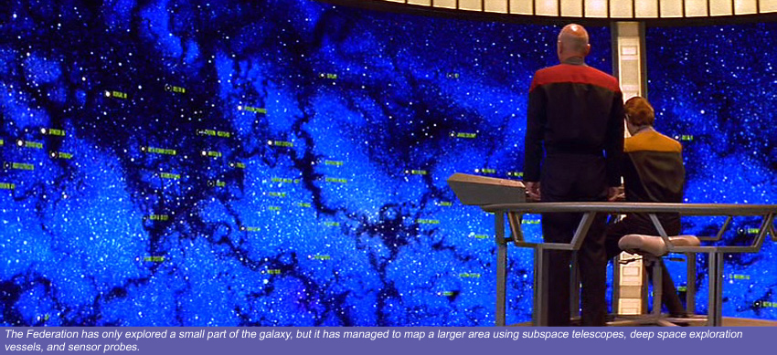
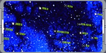
involve a noticeable time lag. Despite these difficulties, the Federation has charted a significant
proportion of the galaxy and uses information gathered from subspace relays, Federation vessels, probes, and
sensor platforms to ensure that its map - which is known as the galactic condition database - is as up to
 date as possible. Starfleet's Stellar Cartography division has plotted the position of stars well beyond the
reaches of manned exploration. Facilities such as the Argus Array, located on the edge of Federation space,
gather data on the position and activity of systems that are light years away from explored space. This data
is constantly updated, and the information transmitted back to Federation outposts. Starfleet also updates
its galactic database by regularly sending probes and deep space exploration vessels into 'new' regions of
space. These vessels, record detailed information which is then transmitted back to other ships and Starfleet
installations by subspace radio.
date as possible. Starfleet's Stellar Cartography division has plotted the position of stars well beyond the
reaches of manned exploration. Facilities such as the Argus Array, located on the edge of Federation space,
gather data on the position and activity of systems that are light years away from explored space. This data
is constantly updated, and the information transmitted back to Federation outposts. Starfleet also updates
its galactic database by regularly sending probes and deep space exploration vessels into 'new' regions of
space. These vessels, record detailed information which is then transmitted back to other ships and Starfleet
installations by subspace radio.
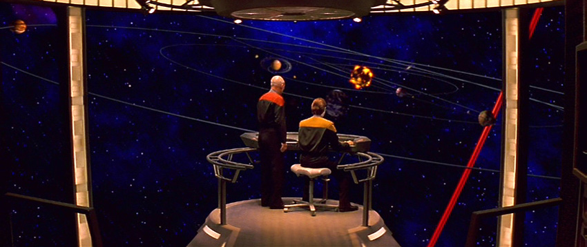
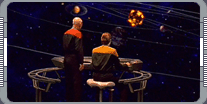
For example, the Stellar Cartography department on the Enterprise constantly observed changes in the
position and movement of stellar phenomena. When it reached a starbase or outpost, detailed logs were
downloaded and transmitted to Starfleet, and integrated into the galactic condition database. This was in
turn distributed to all Federation vessels. Where accurate real-time information was not available,
computers worked to predict conditions with reasonable accuracy.
The information which the Enterprise regularly received from the galactic condition database was combined
with data gathered by the ship's own sensors on the position of stellar activity such a nebulae, pulsars,
and subspace phenomena. These two sources were then combined to more accurately calculate its location and
the relative position of its destination. The Enterprise was equipped with various sensors which ensured
that reliable positional data could be gathered even in difficult conditions such as magnetic storms or solar
flares. During travel, it was essential for the Enterprise's computers to be able to calculate velocity
accurately in order to plot the vessel's position. An extensive network of Federation Timebase Beacons
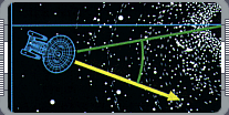 allowed the Enterprise to access the absolute time values used to calculate speed. When the vessel was out
of contact with the beacons, onboard timebase processors maintained records, but these were subject to some
temporal distortion phenomena, and as soon as possible the Enterprise would synchronize them with a timebase
beacon. Time distortion was particularly extreme at high impulse speed, but the ship's guidance and
navigation subprocessors could largely compensate for this. When calculating a course, the Enterprise crew
plotted a flight path that avoided dangerous objects such as stars or other solid bodies. During travel,
the computers constantly updated their flight plans, making the necessary course corrections as new
information became available.
allowed the Enterprise to access the absolute time values used to calculate speed. When the vessel was out
of contact with the beacons, onboard timebase processors maintained records, but these were subject to some
temporal distortion phenomena, and as soon as possible the Enterprise would synchronize them with a timebase
beacon. Time distortion was particularly extreme at high impulse speed, but the ship's guidance and
navigation subprocessors could largely compensate for this. When calculating a course, the Enterprise crew
plotted a flight path that avoided dangerous objects such as stars or other solid bodies. During travel,
the computers constantly updated their flight plans, making the necessary course corrections as new
information became available.
|
|
"USS ENTERPRISE NCC-1701-D" - SEPTEMBER 1999 ISSUE 5 STAR TREK: THE MAGAZINE COPYRIGHT OF PARAMOUNT PICTURES.
|